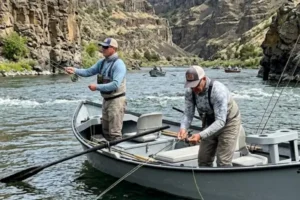

The Tennessee River features a river system marked by wide bends, well-defined meanders, and constant changes in current behavior. These characteristics create highly dynamic environments where water circulation directly influences fish distribution throughout the river.
During periods of increased activity, many species use bends and meanders as movement corridors, feeding areas, and temporary holding zones. In addition, variations in depth, current speed, and natural structures make each section unique.
For this reason, correctly interpreting water behavior within the Tennessee River bends is essential for locating productive areas and better understanding fish movement patterns.
Dynamics of Tennessee River Bends and Their Influence on Natural Water Flow
The bends of the Tennessee River continuously alter both the direction and intensity of the current.
As water moves through winding sections, flow pressure acts differently on the inner and outer portions of the meanders.
Current speed also changes considerably depending on the shape of the bend and the depth of the channel.
These variations create multiple zones of differentiated circulation throughout the river.
As a result, fish distribute themselves according to the specific conditions found in each section of the bend.
Formation of Convergence Zones in Meanders and Increased Activity
Meanders frequently create convergence zones where different currents meet.
These areas concentrate natural food carried by the flow and attract many species throughout the day.
Differentiated circulation also creates stability points where fish can remain with less effort.
Many predatory species use these regions as strategic observation and feeding locations.
Outer Bend Edges as Areas of Greater Predator Activity
The outer edges of river bends usually feature greater depth and stronger current.
This occurs because water pressure gradually erodes the outer banks over time.
As a result, these regions frequently concentrate predatory fish searching for food transported by the main current.
Deep areas near the outer edges also provide greater thermal stability and continuous water circulation.
Inner Bend Zones and Formation of Calmer Areas
The inner portions of bends generally display softer current and shallower depth.
In these areas, water slows down and creates more stable environments compared to the outer edges.
Sediment, submerged timber, and vegetation also frequently accumulate in these sections.
Many species use these calmer zones as temporary holding areas and gradual travel routes.
Interaction Between Variable Depth and Fish Positioning
The bends of the Tennessee River create constant depth changes throughout the channel.
Deep areas near outer edges connect with shallower regions located on the inner portions of the meanders.
This variation forms natural travel corridors used by fish at different times of the day.
Gradual depth changes also frequently concentrate significant activity.
Submerged Structures Created by Bank Erosion
Natural bank erosion creates various submerged structures along river bends.
Exposed roots, partially submerged timber, and small bottom formations alter water circulation and create shelter zones.
These structures also frequently accumulate natural food transported by the current.
As a result, many fish remain close to these regions throughout much of the day.
Influence of Shoreline Vegetation on the Creation of Natural Shelter
Shoreline vegetation strongly influences fish behavior on the Tennessee River.
Trees close to the water, exposed roots, and partially submerged vegetation create shaded regions and areas with reduced current.
These environments also frequently provide greater stability for many species.
Many fish use these locations as holding and travel points along the bends.
Transition Points Between Fast Sections and Stable Areas
Transitions between strong current and calmer water are among the most productive locations within river meanders.
These regions allow fish to remain close to the main circulation without constantly dealing with excessive flow.
Natural food also frequently accumulates in these intermediate zones.
As a result, many species use these areas throughout the day.
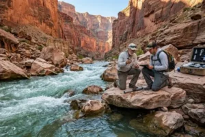
Fish Distribution Along Bends at Different Times of Day
Fish positioning continuously changes throughout the day along the Tennessee River bends.
During periods of softer light, many species increase movement within shallow and intermediate areas.
During brighter periods, fish frequently seek deeper water, submerged structures, and shaded regions.
Temperature changes and current intensity also influence species distribution.
Adjusting Environmental Interpretation According to Changes in Light and Movement
Reading Tennessee River bends requires constant adaptation to environmental conditions.
Changes in light intensity, current strength, and water movement continuously alter fish behavior.
For this reason, productive areas at one moment may display completely different characteristics only a few hours later.
The ability to adjust observation significantly improves river interpretation.
Influence of Current on the Formation of Natural Corridors
The current of the Tennessee River shapes natural corridors throughout bends and meanders.
These corridors function as travel routes used by fish searching for food and stable conditions.
Changes in flow intensity also create multiple differentiated circulation zones.
Understanding how water moves around the bends greatly improves environmental reading.
How Sediment Changes the Behavior of River Bends
Sediment transported by the current continuously modifies the structure of the bends.
In some areas, sand and organic material gradually accumulate, while other sections experience stronger erosion.
These changes alter depth, water circulation, and fish positioning.
Observing sediment behavior greatly helps identify productive locations.
Importance of Observing Shorelines
The shorelines of the Tennessee River provide many important clues about water behavior.
Changes in vegetation, eroded banks, and side inlets frequently indicate variations in current and depth.
Many productive structures also form close to the most irregular shoreline sections.
Careful observation of these areas significantly improves river interpretation.
Species Adaptation to Current Changes
Fish species in the Tennessee River constantly adapt to changes created by bend dynamics.
Throughout the day, different species shift positioning according to flow intensity, depth, and light conditions.
Some species use stronger-current areas, while others prefer more stable regions.
This continuous adaptation directly influences fish distribution throughout the river.
Common Mistakes When Interpreting Curves and Meanders
Some mistakes greatly reduce the ability to identify productive areas:
- Ignoring transition zones between currents
- Fishing only deep areas
- Failing to observe submerged structures
- Overlooking light changes throughout the day
- Staying too far from structured shorelines
- Ignoring current behavior within bends
- Failing to adapt interpretation according to water movement
Avoiding these mistakes significantly improves environmental interpretation.
The curves and meanders of the Tennessee River create highly rich and dynamic environments for many fish species.
The combination of current, variable depth, submerged structures, shoreline vegetation, and transition zones directly influences fish distribution and behavior throughout the river.
Understanding how water moves through the bends also helps identify far more productive areas at different times of the day.
With continuous observation and constant adaptation, reading the Tennessee River becomes increasingly precise, allowing a deeper understanding of the dynamics of this important river system.