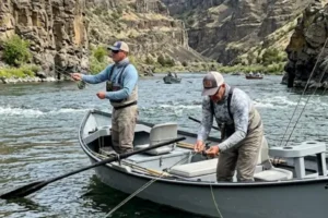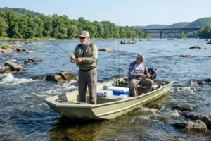
The Mississippi River is one of the largest and most diverse river systems in North America. Its wide variety of environments creates ideal conditions for many predatory fish species throughout nearly the entire year. During periods of increased activity, many fish move more aggressively in search of food, using currents, submerged structures, and depth variations to optimize movement and feeding opportunities.
In this scenario, correctly identifying the most productive locations becomes essential for improving fishing efficiency. Small changes in current flow, water color, or bottom structure can completely alter fish distribution throughout the river.
In addition, the Mississippi features dynamic conditions that vary according to season, water level, and flow intensity. For this reason, understanding environmental patterns greatly helps anglers select the most promising areas during periods of increased predator fish activity.
The Mississippi River During High Activity Periods
During periods of increased activity, predatory species tend to move more frequently between feeding areas, resting zones, and travel routes.
On the Mississippi River, these movements are mainly influenced by current flow, water temperature, and natural food availability.
Fish behavior also changes throughout the day. During some periods, fish remain close to deep structures, while at other times they move toward shorelines, secondary channels, and areas with greater prey concentration.
For this reason, continuous environmental observation is essential for locating productive fishing zones.
Reading Secondary Currents and Their Impact on Fish Feeding Activity
Secondary currents play an extremely important role in predator fish movement.
These currents commonly appear near channel entrances, river bends, natural obstacles, and depth transitions.
In many situations, they create moderate-flow zones where baitfish and other aquatic organisms naturally concentrate.
Secondary currents also allow predatory fish to conserve energy while remaining close to feeding areas.
Learning to identify these regions greatly helps anglers locate productive areas throughout the Mississippi River.
Identifying Channel Edges and Transition Zones
Channel edges are extremely important areas in large river systems.
These regions function as natural travel corridors for many predatory species.
On the Mississippi, transitions between shallow and deep water frequently concentrate active fish, especially during stronger feeding periods.
Gradual depth changes also create different current conditions and water circulation patterns.
Predatory fish often use these edges to monitor natural prey carried by the river flow.
Common Submerged Structures in Productive Sections
Submerged structures are fundamental elements in fish distribution throughout the Mississippi River.
Submerged timber, fallen trees, rock formations, and bottom irregularities provide shelter, resting zones, and strategic feeding positions.
These structures also alter current behavior, creating differentiated circulation zones that attract various species.
In addition, many fish use these areas as holding locations during environmental changes.
Correctly identifying submerged structures significantly increases the chances of locating productive fishing areas.
Water Convergence Areas and Natural Prey Accumulation
Convergence areas occur when different water flows meet within the river system.
These regions often concentrate natural food carried by the current, including baitfish and other aquatic organisms.
As a result, predatory species frequently remain near these zones waiting for feeding opportunities.
Convergence areas also create visible surface changes, making them easier to identify while navigating the river.
These locations are among the most productive environments on the Mississippi during periods of increased activity.
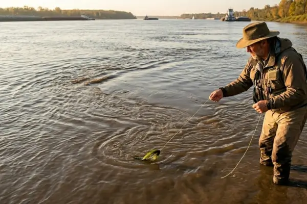
Influence of Water Turbidity on Predator Fish Distribution
Water turbidity significantly changes predator fish behavior.
In murkier water, many fish move closer to structures and lower-light areas to improve movement and feeding efficiency.
In clearer conditions, some species shift toward deeper areas or natural cover.
Changes in turbidity also frequently modify fish positioning throughout the day.
Observing water coloration greatly helps anglers choose more productive fishing locations.
Resting Areas in Strong Current Sections
In areas with strong current flow, fish usually seek regions requiring less energy expenditure.
These resting zones commonly appear behind obstacles, near bottom irregularities, and in side-current areas with reduced flow.
Even during high activity periods, many species alternate between active movement and remaining in these more protected areas.
These resting zones are often positioned close to active feeding locations.
This proximity makes them extremely valuable for fishing and observation.
How Shoreline Vegetation Affects Fish Concentration
Shoreline vegetation strongly influences fish distribution throughout the Mississippi River.
Exposed roots, overhanging branches, and shaded shoreline areas create favorable conditions for small aquatic organisms and baitfish.
As a result, predatory species frequently move near these regions searching for feeding opportunities.
Vegetation also partially reduces current intensity in certain areas, creating productive holding zones.
Depth Variations and Their Effects on Fish Behavior
Depth changes directly influence predator fish positioning.
In many situations, fish use deeper areas as holding zones during periods of stronger light or heavier current flow.
Intermediate and shallow regions may show greater activity during specific times of day.
Abrupt bottom changes also frequently function as feeding and travel routes.
Observing these variations greatly helps anglers interpret fish behavior throughout the river.
Adjusting Environmental Reading Throughout the Day
Conditions on the Mississippi River constantly change throughout the day.
Variations in light, temperature, current speed, and natural food movement directly influence predator fish activity.
For this reason, environmental interpretation must remain continuous and adaptable.
Areas that are productive in the morning may display completely different behavior later in the day.
Maintaining constant attention to environmental signals greatly improves the ability to identify promising fishing zones.
Influence of Water Level on Fish Distribution
Water level significantly alters available fish structure.
During rising water periods, new shoreline zones and partially submerged structures become part of the active river environment.
During lower water levels, many fish concentrate closer to main channels and deeper regions.
Changes in water level also modify current speed in many river sections.
Understanding these variations greatly helps adjust environmental interpretation.
Using Surface Observation as a Reading Tool
The water surface provides important signals about overall environmental activity.
Baitfish movement, current changes, and color variations frequently indicate productive areas.
Specific surface disturbances may also reveal submerged structures, convergence zones, and depth changes.
Developing the habit of continuously observing the water surface significantly improves fish location abilities.
Importance of Mobility When Searching for Productive Areas
On the Mississippi River, mobility is extremely important.
Because fish behavior changes rapidly according to environmental conditions, moving between different areas greatly increases opportunities for locating active fish.
Exploring secondary channels, structured shorelines, and transition zones also helps expand overall understanding of the river system.
Anglers who constantly adjust their position tend to interpret fish behavior changes more effectively.
Common Mistakes When Identifying Productive Areas
Some mistakes make locating fish much more difficult:
- Staying too long in inactive areas
- Ignoring current changes
- Fishing at the same depth continuously
- Failing to observe surface activity
- Overlooking the influence of turbidity
- Fishing too far from primary structures
- Ignoring transition and convergence zones
Avoiding these mistakes significantly improves environmental interpretation.
Identifying productive areas on the Mississippi River during periods of increased predator fish activity requires constant observation, environmental interpretation, and continuous adaptation.
The combination of reading secondary currents, analyzing submerged structures, observing depth variations, and interpreting water turbidity allows anglers to locate far more productive areas throughout the river.
In addition, understanding how fish use resting zones, convergence areas, and shoreline vegetation helps develop more efficient fishing strategies under different conditions.
With practice and experience, reading the Mississippi River becomes increasingly precise, allowing anglers to take full advantage of the enormous potential of this remarkable river system.